Download RadarNow! for Android on Google Play
Many people have asked about the “blurriness” or “pixelation” of the radar imagery RadarNow!® presents in local station mode. They usually mention how other apps display sharp and crisp images with house-level resolution. Why don’t I see this on RadarNow!®?
For those of you who wonder, here’s a primer on radar images that may help explain. Essentially, the resolution of a radar image from NOAA is about 1/2 a mile. That means that the size of every dot, or pixel, in the radar image is roughly one-half mile square.
Okay, so what does that mean really?
If each pixel shows a half a mile square, then that half a mile square area is one color. Display the entire 70,000 square mile area of a local radar and you get a nice picture with plenty of detail. As you zoom in, you start losing detail. Each zoom level in RadarNow!® doubles the magnification of the image, so you get half the resolution of the previous level. If the full-size image is 300 miles across and the map is zoomed in one level, you’re now looking at 150 miles across. The next zoom level cuts that in half again, so now it’s 75 miles from edge of your screen to edge of your screen, and so forth.
Putting this in terms of the resolution of the original image: when the local radar circle fills your screen from edge to edge, that circle is about 640 pixels across. Zoom in once, and now only 320 dots of full resolution data are being shown. Next zoom cuts that to 160 and then 80 after zooming in only four times. As the picture zooms in, you get fewer and fewer pixels of real data.
Okay, so what does that really, really mean?
At zoom level 10, only 20 dots of data are being shown across your screen. Those 20 dots still show a half a mile square each but are now large, visibly square blocks in the image. The edges are indistinct and no longer crisp. That’s pixelation in a nutshell.
So why do other apps showing radar displays show crisp lines that I can see on their map when I’m looking at my street and house?
Those apps all use a computer algorithm to enhance the image. This makes for a prettier picture, but that pretty picture is lying to you by adding data. They start with the same half mile square piece of data, then using computer magic, make it look like there is more to show than is actually present. This information can be misleading since it is based on a mathematical calculation and not actual, detected precipitation data. Another issue with this type of display is that it takes more time to produce delaying the display of the radar image on your device. That time can be critical when looking at an approaching storm.
So why doesn’t RadarNow! do the same so I can see where the storm is on my street?
We use the radar imagery that is produced by NOAA without enhancement. We don’t alter it in any way except to enlarge their images using standard image enlargement functions. We don’t try and add “data” to the image that was mathematically inserted by some computer algorithm. It is our opinion that this would be presenting you with false, misleading and potentially, even dangerous information. We don’t expect our users to make important weather decisions based on computer dreams. We provide the actual data, direct from the source. We get the image virtually as soon as it is available, delivering it to your device as fast as possible. We believe that showing the most current and accurate radar image possible with the least amount of processing is the best choice for weather awareness.
RadarNow!® will zoom to level 12 only. Level 14 or 15 is required to see a residential sized street and level 17 to see your house. At these extreme zoom levels, it’s pointless to show the radar picture since only part of the half mile square pixel from the original image takes up more than the entire screen. At zoom level 12, there are enough pixels from the original radar image being displayed to make sense of what is going on with the weather.
Clutter Suppression
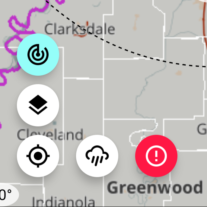
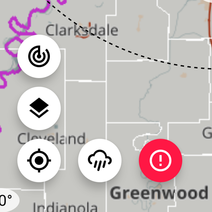
We do offer ground clutter suppression on the local radar imagery as an enhanced image. Clutter suppression is turned on by touching the icon that shows as a radar screen. This icon is only available when displaying the local radar stations. The composite view (full US image) has clutter suppression built in. The clutter suppression icon is located at the top of the stack of icons at the bottom-left corner.
Download RadarNow! for Android on Google Play
For any questions or concerns about RadarNow!, please use the “Contact us” form inside of RadarNow! (off the left navigation menu) to request support. We answer all support requests within three days and often, within ten minutes. Thanks!
