Download RadarNow! for Android on Google Play
Starting with release 7.2.286, RadarNow! does show snow, and other forms of precipitation as we’ve added a new layer to the Mosaic overlay.
With the addition of Precipitation Type, RadarNow! uses two Mosaic types:
- Precipitation intensity: The standard radar with reds and purples being the most intense and light blue being the least.
- Precipitation type: A color-coded visualization that distinguishes between different types of falling precipitation, such as rain, snow, sleet, and freezing rain.
Here’s what the Precipitation type layer looks like in RadarNow!
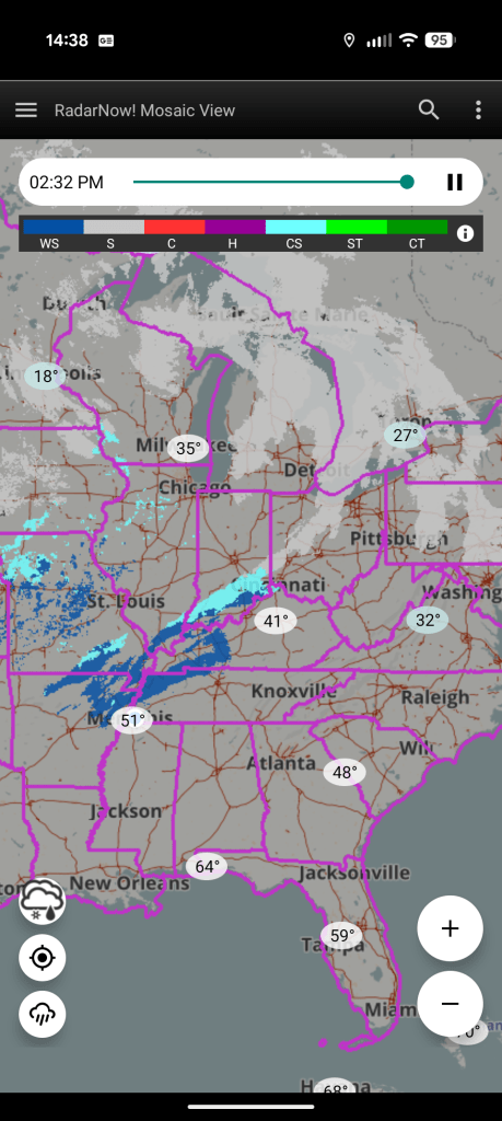
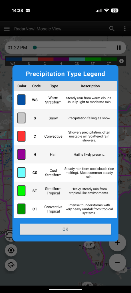
The color code under the progress bar makes it easy to understand what the display shows. Touching the color key brings up this help page:
We’ve noticed that the map background color can appear the same as the color of snow under some opacity conditions. If you find it difficult to pick out snow from the map background, open the layers and opacity menu (left navigation pane, three horizontal bars, top-left) and adjust the map layer opacity a bit.
For any questions or concerns about RadarNow!, please use the “Contact us” form inside of RadarNow! (off the left navigation menu) to request support. We answer all support requests within three days and often, within ten minutes. Thanks!
