Download RadarNow! for Android on Google Play
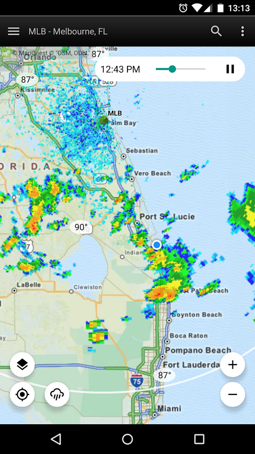
When users first start out using RadarNow!, they sometimes can be disappointed in the way we depict radar imagery. Zoomed out, RadarNow! appears like many radar apps. An overall view showing from edge to edge of the screen with an animated, looping view. This is referred to as a “composite” view. When zoomed in, the view changes from the edge to edge view to a view bounded by a white ring showing only a limited area.
While it may seem like this is limiting, the reason for doing this is to show the most recent radar imagery from the radar station itself. The composite view is built up from the individual station images on a time schedule, usually about every ten minutes. The time between images in the local view can vary from once every three to once every ten minutes. There is no set schedule for the local view. Typically, when weather is in the area, the view is updated every six minutes.
The true advantage is that the local view can be much more up to date than the composite. Perhaps as much as 12 minutes or even more. Typically, all apps show the composite view and show the time the VIEW WAS CREATED, not the time of the actual imagery. This can be quite misleading and cause weather decisions to be made with erroneous data.
By showing the local view when zooming in, your most immediate weather needs are met with the most up to date radar imagery possible, bar none. The only way you’d get a more up to date image is if you were seeing an actual sweep of the radar, like they show on TV often.
When you see the white ring with no radar imagery outside of it, you’re at a local view from a particular radar station. You can switch between modes by doing a long press on the zoom buttons. The + button switches to local mode and the – button switches to composite mode.
Download RadarNow! for Android on Google Play
For any questions or concerns about RadarNow!, please use the “Contact us” form inside of RadarNow! (off the left navigation menu) to request support. We answer all support requests within three days and often, within ten minutes. Thanks!
